Yuneec H and Intel Intellisense sensors
| cgoet-manual | mainteanance | pilot-manual |
Overview
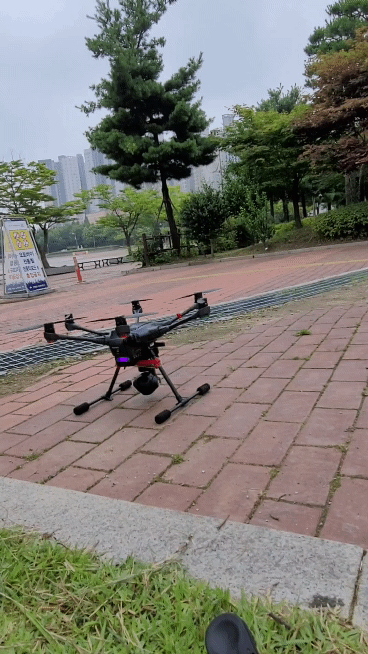
Typhoon H Hexacopter
 |
Autonomous flight modes allow you to recall pre-programmed tracking shots while focusing on the camera:
Orbit Me: Typhoon H flies a circular path around you, keeping the camera trained on you the whole time. Point of Interest (POI): Select a subject and Typhoon H will orbit that subject autonomously. Journey Mode: Typhoon H will automatically go up and out, as far as 90 m, and capture the perfect aerial selfie. Follow Me / Watch Me: Follow Me ensures Typhoon H moves along with you. Watch Me tells Typhoon H to follow you while always pointing the camera at you wherever you go.
Curve Cable Cam: Easily program an invisible route for Typhoon H to fly along. Typhoon H will fly between pre-set coordinates while independently controlling camera position.
Return Home: Simply switch to Home Mode and Typhoon H will return and land within 8 m of you.
CGOET Thermal Imaging And Low-Light Camera
The CGOET is an innovative combination of 3-axis gimbal, thermal imaging camera and low-light camera. While the thermal imaging camera selectively measures the temperature in the image enabling it to display relative temperature differences, the low-light RGB camera has a 20 times higher sensitivity than the human eye and can still take excellent shots even in low light conditions. Both images are streamed live on your remote control at the same time, and can be viewed separately as a picture-in-picture or as an overlay. The CGOET gimbal is capable of continuous 360° yaw axis rotation. This unique feature, when combined with the H520 retractable landing gear, provides the operator with continuous 360 unobstructed camera view and the ability to continuously pan the camera without yawing the airframe.
ST16 All-in-One Transmitter
Scope Of Delivery
The Typhoon H with CGOET includes: Typhoon H hexacopter, CGOET thermal imaging and low-light camera, ST16 remote control, 1 battery, user manual and accessories.
Everything At A Glance
| DRONE: | ————— |
|---|---|
| Dimensions: | 480 x 425 x 295 mm |
| Weight: | 1,9 kg |
| Battery: | 4S 14,8V 5400mAh LiPo |
| Charger: | SC4000-4 |
| Remote Control: | ST16 |
| Max. Flying Altitude: | 122 m (preset) |
| Max. Rate Of Ascent: | 5 m/s |
| Max. Rate Of Descent: | 3 m/s |
| Max. Rotation Angle: | 35° |
| CAMERA: | ————— |
| Camera Dimensions: | 81 x 108 x 138 mm |
| Sensor: | 1/3″ 2M |
| ISO Range: | 100 – 12800 |
| Shutter Speed: | 1/30 – 1/8000s |
| Video Resolution: | 1920 x 1080p / 30 FPS |
| Photo Format: | JPEG, TIFF (14bit RAW) |
| Video Format: | MP4 |
| FOV, diagonal: | Low-light camera: 90° // thermal imaging camera: 71° |
| FOV, horizontal: | Thermal imaging camera: 56° |
| Sensitivity: | < 50 mK |
| Thermal Imaging Camera: | uncooled VOx microbolometer |
| LWIR Wave Length: | 8 – 14 μm |
| Temperature Equalisation: | automatic |
| Temperature Measuring Range: | -10° – 180° |
| REMOTE CONTROL: | ————— |
| Operating System: | Android™ |
| Number of Channels: | 16 |
| Controller Battery: | 3,6 V 8700 mAh 31,32 Wh Li-Ion |
| Transmission Distance Range (Optimum Conditions): | Up to 1,6 km |
| Video Link Resolution: | HD 720p |
| Video Link Frequency Band: | 5,8 GHz WiFi |
| Display Screen: | 7″ |
| Tactile and Audio Feedback: | Yes |
| Telemetry Data on Screen: | Yes |
LED and Wizard status indicators
LED STATUS INDICATIONS DURING STARTUP
| Main LED Status Indicator | ||
| - Initialization failed | Pulses red (3 times per second) | initialization failed  |
| - The Aircraft is in “Bind” Mode | Blinks orange very rapidly ( 10 times per second) | Bind mode  |
| - The Aircraft is in a No-Fly Zone * * Please see the instrucion manual for more information regarding no-fly zones | Blinks red and whilte rapidly (5 times per second) | no-fly zone  |
| LED STATUS INDICATIONS BEFORE/DURING FLIGHT | ||
| Main LED Status Indicator | ||
| - The Aircraft is in Smart Mode with GPS lock | Glows sold green | smart mode  |
| - The Aircraft is in Smart Mode without GPS lock | Blinks green (3 times per second then off (for 1 second)) | S without gps  |
| - The Aircraft is in Angle Mode with GPS lock | Glows solid purple | Angle mode w/GPS  |
| - The Aircraft is in Angle Mode without GPS lock | Blinks purple (3 times per second) then off (for 1 second) | A without gps  |
| - The Aircraft is in Home Mode | Blinks red rapidly (5 times per second) | Home mode  |
| - Enter Task function | Blink green and purlple slowly ( 1 time per second) | Task  |
| - First Level low Voltage Battery Warning | Blink red, green and blue every 3 seconds | Battery warning  |
| - Second Level low Voltage Battery Warning | Blinks red, green and blue continuously | Battery Alarm  |
| - GPS Disabled NOTICE: White blink between solid flight mode indicates enough satellites for Watch Me/Follow Me. | Blinks purple (1 flash per second) | GPS disabled  |
| LED STATUS INDICATIONS FOR CALIBRATION MODES Main LED Status Indicator | ||
| - Compass Calibration Mode Entered | Blinks red and green slowly (2 times per second) | Compass  |
| - Compass Calibration Started | Blinks red and green rapidly (5 times per second) | Compass started  |
| - Accelerometer Calibration Mode Entered | Blinks red, green and blue slowly (1 times per second) | Accelerometer  |
| - Accelerometer Calibration started | Blinks red, green and blue rapidly (3 times per second) | Accelerometer config started  |
| - Calibration failed | Glows solid white | Failed  |
| CGO3+ CAMERA LED STATUS INDICATIONS | ||
| - Without T-card or T-card Memory Full | T-card error  |
|
| - WiFi Error | ||
| - WiFi Initialized | ||
| - WiFi Connected | ||
| - Recording Video or Taking Still Photos | ||
